

6 Advanced Navigation Tools Wildland Firefighters Rely On
Last Updated: October 30, 2026
Quick Summary
Advanced navigation tools for wildland firefighters are the hardware and software that answer where you are, where the fire is, and where your crew is. No device replaces a compass and paper topo map, so the tool assists while land-navigation skill decides.
- NIFC's Wildland Fire Open Data site replaced GeoMAC in May 2020 and now gives the public fire-perimeter maps.
- Mark critical points like escape routes and water sources by standing still for a full fix rather than tapping and walking.
- Test runtime yourself by running the unit in tracking mode overnight in the cold and logging how long it lasts.
- Mil-spec drop ratings (MIL-STD-810) mean more for wildland work than any screen-brightness spec.
- A tracker reporting every five minutes is fine for accountability but too slow for a fast-moving flank.
Table of Contents
- What Advanced Navigation Tools Actually Do on the Line
- Wildland Firefighter GPS Devices: What Separates Field-Ready Units
- Offline Maps for Wildland Firefighters: Dead-Zone Performance
- Wildfire Mapping Software and Real-Time Perimeter Data
- Wildland Fire Situational Awareness Tools: Tracking Crews and Sharing Data
- Communications, Costs, and Procurement Trade-Offs
- Common Mistakes When Buying Navigation Gear
- Gear Up Before Your Next Assignment
- Frequently Asked Questions
What Advanced Navigation Tools Actually Do on the Line
Advanced navigation tools for wildland firefighters are the hardware and software that answer three questions under pressure: where you are, where the fire is, and where your crew is. The National Interagency Fire Center reports that its Wildland Fire Open Data site now provides fire-perimeter maps to the public, having replaced GeoMAC in May 2020, per NIFC Information Technology program page. That shift moved perimeter data from a specialist system to an open portal any crew boss can check.
No device replaces a compass and a paper topo map. A Northern Michigan University wildland-fire land-navigation course still teaches compass use, GPS receivers, clinometers, and topographic-map interpretation side by side, per NMU RE 170 course description. That tells you what the pros already know.
This guide breaks down what separates field-ready gear from office-grade gadgets, where dead zones will hurt you, and what to skip. There's no single perfect unit.
Wildland Firefighter GPS Devices: What Separates Field-Ready Units
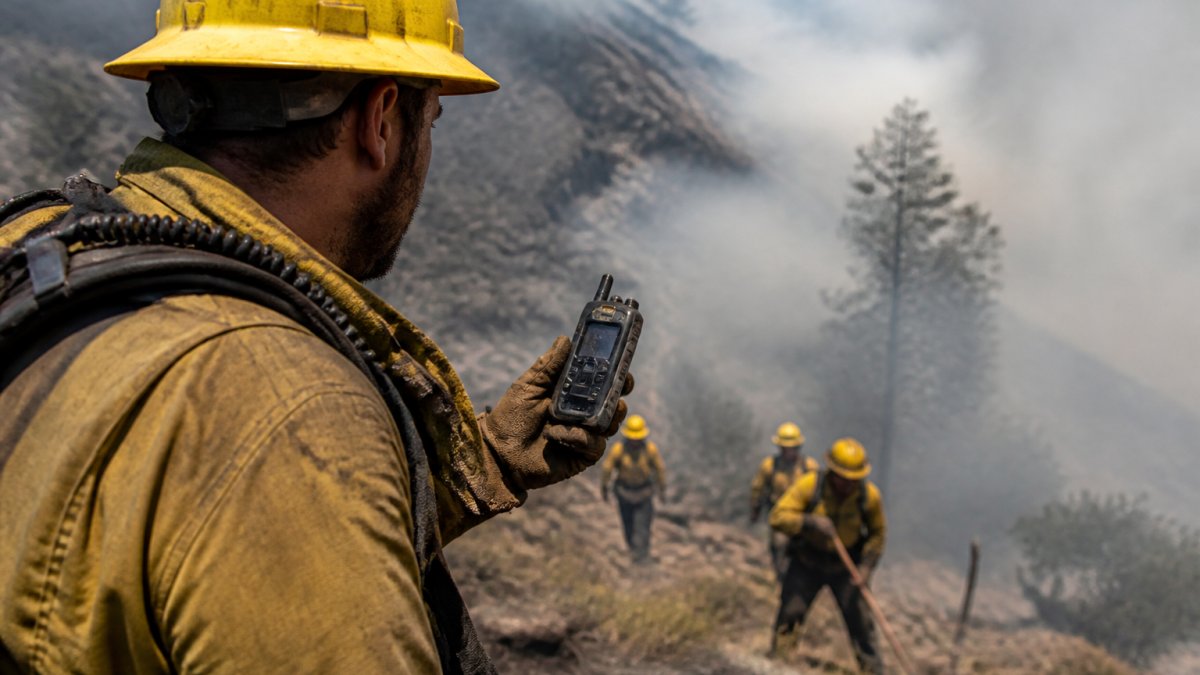
A field-ready wildland firefighter GPS device survives three things a phone won't: gloves, smoke, and a 14-hour shift. The useful question is which unit still answers "where am I" after eight hours in cold smoke with a wet glove. That comes down to four criteria: position accuracy, update latency, battery behavior under load, and verifiable durability.
Accuracy, Latency, and Battery Life
Accuracy matters less than you'd think.
Latency is the real issue. A position that updates every 30 seconds is useless when you're moving through a chimney of dead timber.
Battery life is where cheap units fall apart. Cold drains lithium cells fast. Look for units rated for sub-freezing operation and carry spare cells in an inside pocket, not a pack, so body heat keeps them alive.
Durability Ratings That Matter
IP ratings tell you water and dust resistance. IP ratings describe water and dust resistance under specific test conditions. Those ratings are a floor, not a guarantee, because they don't describe drops, vibration, or glove use.
Mil-spec drop ratings (MIL-STD-810) mean more for wildland work than any screen-brightness spec. The standard covers a family of tests, including drops, vibration, and temperature extremes, so ask which specific methods a vendor tested and at what levels rather than accepting a bare "mil-spec" badge.
What to Ask Before You Buy
- Does it track GPS plus at least one other constellation, and what is the update interval in tracking mode?
- What is the tested runtime at freezing, not at room temperature?
- Which MIL-STD-810 methods were tested, and at what drop height?
- Can you operate every critical function with a wet glove?
- Does it accept standard map formats and export tracks in a format your incident command can read?
Offline Maps for Wildland Firefighters: Dead-Zone Performance
Offline maps for wildland firefighters are pre-downloaded topographic and fire-perimeter layers stored on the device, so navigation keeps working when cellular and radio coverage drop.
Storage is the other trap. High-resolution topo tiles for a large incident area eat gigabytes fast. Budget storage like you budget water: more than you think, and know where the spare card lives.
Wildfire Mapping Software and Real-Time Perimeter Data
Wildfire mapping software turns satellite, aerial, and field data into a live map of fire perimeter and behavior. The National Interagency Fire Center describes WildFireSA Advanced as combining collaborative mapping, geospatial and imagery analysis, and reporting, per NIFC WildFireSA Advanced overview.
Aerial sensing is changing this fast. If you're following a specific incident, our Palisades Fire 2025 collection tracks the kind of event these mapping systems were built to cover.
Here's the honest limit: perimeter data is only as current as its last update. Treat a live map as an estimate rather than a certainty. Fire weather and wind shift faster than any satellite pass.
Wildland Fire Situational Awareness Tools: Tracking Crews and Sharing Data
Wildland fire situational awareness tools are the systems that show a supervisor where every crew and asset sits in real time. GPS-based firefighter and asset tracking, crew location visibility, and a shared common operating picture all fall under this umbrella. Reliable data synchronization across these diverse platforms remains as critical to mission success as carrying essential backcountry gear when operating in remote, disconnected terrain.
How a Shared Operating Picture Actually Works
A common operating picture is built in layers. Field units (handhelds, vehicle trackers, and app-based trackers on rugged phones) report position and status over whatever channel is available: LTE where it exists, satellite messengers where it doesn't, and store-and-forward when neither is live. A server or incident-command platform ingests those reports, time-stamps them, and publishes them to a map dispatchers, division supervisors, and incoming crews can all view.
That is why the practical questions are about data flow, not screen size:
- Update cadence: How often does a field unit report, and how long does it take a position to appear on the incident map? A tracker that reports every five minutes is fine for accountability but too slow for a crew working a fast-moving flank.
- Time-stamping: Does the system show when each position was last updated? A stale icon that looks live is worse than no icon, because it invites decisions on old information.
- Status fields: Can crews flag "assigned," "moving," "emergency," or "out of service" without typing? Status is often more useful to a supervisor than raw coordinates.
Interoperability Across Agencies
The hard part isn't the technology. It's getting three agencies with three systems to see the same map.
In practice, interoperability means position and track data export in common geospatial formats such as GPX or KML, and incident maps publish as standard map services other platforms can consume.
A useful test before purchase: ask the vendor to demonstrate a two-way exchange with a system you don't own.
Data Governance and Cybersecurity
Data governance matters here too. Location tracking raises real privacy and cybersecurity questions. Know who owns the data, where it's stored, and who can access it before you deploy tracking across a crew. Continuous personnel tracking creates a sensitive record of where every member was and when. Ask whether data is encrypted in transit and at rest, how long it is retained, and whether it can be purged after an incident.
A Practical Evaluation Checklist
- Does the system show last-update time for every position?
- Can field units report over LTE, satellite, and store-and-forward, and does it fall back automatically?
- Does it export tracks in GPX or KML and publish incident maps as standard services?
- Can it exchange a live feed with an incident-command platform you don't own?
- Who owns the location data, where is it stored, and how is it encrypted and retained?
Get satisfactory answers to those five questions and you have a situational awareness tool that can be shared across an incident, not just a dashboard that looks impressive in a demo.
Communications, Costs, and Procurement Trade-Offs
Communications are often the first thing to fail in the wildland environment, so build redundancy into the plan.
Costs and procurement deserve careful thought. Ongoing support, subscriptions for mapping layers, replacement batteries, and training add up over a multi-year lifecycle.
| Decision Factor | What to Ask | Why It Matters |
|---|---|---|
| Connectivity | Does it work with no LTE or radio? | Dead zones are the norm, not the exception |
| Battery | Rated hours below freezing? | Cold cuts runtime sharply |
| Durability | IP68 and MIL-STD drop rating? | Gloves, smoke, and drops are daily |
| Interoperability | Exports standard geospatial formats? | Mutual-aid partners must share the map |
| Lifecycle cost | Total cost over 3-5 years? | Support and subscriptions outlast the hardware |
Buying on unit price alone is a common procurement mistake. A cheap handheld with no support path can quickly become e-waste.
Common Mistakes When Buying Navigation Gear
The biggest mistake is treating a navigation device as a replacement for land-navigation skill. It's an aid. The compass, the topo map, and the clinometer still earn their place in the pack.
Second mistake: buying for the brochure instead of the glove. If you can't operate it with a wet glove in low light, it's the wrong tool. Third: skipping the offline test.
If you're thinking through practical gear selection more broadly, our guide to essential hand tools for residential fire entry covers the same buying logic for forcible-entry equipment: fit the tool to the job, not the catalog.
Gear Up Before Your Next Assignment
The right navigation setup keeps you found. The right gear reminds you who you are out there. Black Helmet has served more than 100,000 firefighters since 2008, building apparel for the fire service.
Our Wildland Firefighter Premium Tee is designed for the job. If you're outfitting a station or a crew, browse the full Fire Rescue collection for apparel and accessories that carry the brotherhood. And if you're investing in crew identity, our piece on why authentic brotherhood gear matters for fire crews explains why the real thing beats a knockoff.
Frequently Asked Questions
What navigation tools do wildland firefighters use?
Crews carry a mix: handheld GPS units, rugged tablets and phones running field applications, paper topographic maps with compass and clinometer, and land mobile radios for voice contact. Many also pull fire-perimeter data from shared geospatial portals. Fire-perimeter maps are available from shared geospatial portals, and training programs teach compass, GPS receiver, clinometer, and map interpretation together, so no single device carries the whole job.
Can firefighters use offline maps when there is no cell service?
Yes, and they should plan for it. Offline maps for wildland firefighters need to be downloaded before deployment, not during it. Cache the tiles for your assignment area, verify the download completed, and carry a paper backup. Remote terrain routinely drops LTE coverage, so a device that only works with a live connection is a liability. Test the offline map on the device you will actually carry, in airplane mode, before you leave the station.
How do digital mapping tools help crews track fire perimeters?
Wildfire mapping software pulls perimeter data from shared geospatial platforms and aerial sensing, then displays it against crew positions. Shared geospatial platforms publish fire-perimeter maps, and some aerial sensing programs support real-time perimeter mapping. For a crew, that means the live map shows where the fire was last mapped and where you are relative to it. Treat perimeter data as a snapshot with a timestamp, not a guarantee of the fire's current edge.
How should crews prepare navigation tools before deployment?
Charge every device and pack spare batteries or power banks. Download offline maps for the assignment area and confirm they open without a signal. Load the current fire-perimeter data and note its timestamp. Check that radios are programmed with the correct frequencies and that everyone knows the plan for lost connectivity. Confirm your LCES setup, escape routes, and safety zones are marked on both the digital map and the paper copy. A short pre-deployment check catches most field failures before they matter.
Navigation gear fails when it's bought for the brochure instead of the line. Black Helmet builds apparel for wildland and structural crews who want gear that reflects the work, with original designs, family-owned roots, and a satisfaction guarantee behind every order. Get started with Black Helmet and gear up for your next assignment.

